Gulasshire Junction
Elevation 560 feet.
A footpath branches off from the bridleway. A small rock formation can be seen nearby.
Travel
- Follow the bridleway
east
The signpost reads: - Gulasshire, a halfling village, ¼ mile
- Toboby, a halfling hamlet, 3 miles
- Follow the bridleway
north
The signpost reads: - Wragden, an otterfolk village, 2¼ miles
- Follow the footpath
west
The signpost reads: - Port Rugegate, a human village and port, 5½ miles
Nearby Locations
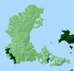
All nearby locations within 5 miles. Note: distances given are as the crow flies.
- Bandit Camp, a bandit-camp, 2 miles away
- Toboby, a halfling hamlet, 2¼ miles away
- Bandit Camp, a bandit-camp, 2½ miles away
- Toboby Docks North, a dock, 2¾ miles away
- Porroworth, a longfoot hamlet, 3 miles away
- Port Rugegate, a human village and port, 3¼ miles away
- Mineton, a halfling hamlet, 3½ miles away
- Bandit Camp, a bandit-camp, 3½ miles away
- Anchoton, a halfling village, 4 miles away
- Wetherend Docks, a dock, 4 miles away
- Mineton Junction, a crossroads, 4 miles away
- Ningdalhalh Docks, a dock, 4¼ miles away
- Laurahalh Docks, a dock, 4½ miles away
- Port Grangehead, a human village and port, 4½ miles away
- Ningdalhalh, a gnomish hamlet, 4¾ miles away
- Soutpend Junction, a crossroads, 4¾ miles away
- Anchoton Docks, a dock, 4¾ miles away
- Laurahalh, a gnomish hamlet, 4¾ miles away
- Soutpend, a human hamlet, 4¾ miles away
- Wetherend, a human hamlet, 5 miles away