Brunrasglind Junction North
Elevation 590 feet.
A fork in the footpath.
Travel
- Follow the footpath
south-east
The signpost reads: - Brunrasglind, a gnomish hamlet, ½ mile
- Follow the footpath
north
The signpost reads: - Port Modden, an otterfolk village and port, 2 miles
- Follow the footpath
north-west
The signpost reads: - Pateter Beacon, a beacon, 9½ miles
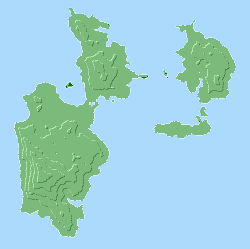
Nearby Locations
All nearby locations within 5 miles. Note: distances given are as the crow flies.
- Brunrasglind Junction South, a crossroads, 1 mile away
- Brunrasglind Docks, a dock, 1½ miles away
- Gillton Junction, a crossroads, 1½ miles away
- Tetwich, a human hamlet, 2 miles away
- Gillton, a longfoot hamlet, 2¼ miles away
- Port Modden Junction, a crossroads, 2¼ miles away
- Netherden Docks, a crossroads, 2½ miles away
- Tetwich Docks East, a dock, 2¾ miles away
- Netherden, an otterfolk village, 3 miles away
- Gillton Docks, a dock, 3 miles away
- Baldstead, a longfoot village, 3¼ miles away
- Port Stockden, an otterfolk village and port, 3¼ miles away
- Baldstead Junction North, a crossroads, 3¼ miles away
- Port Stockden Junction, a crossroads, 3½ miles away
- Tetwich Docks West, a dock, 3½ miles away
- Eden Junction South, a crossroads, 3½ miles away
- Port Stafden, an otterfolk hamlet and port, 3¾ miles away
- Eden, an otterfolk village, 3¾ miles away
- Eden Junction North, a crossroads, 4¼ miles away